Winter wheat is the problem crop for optical satellite monitoring. It germinates in fall, overwinters under variable cloud cover and snow, resumes growth in early spring when cloud frequency is highest across the Great Plains, and reaches critical developmental stages in April and May — months that average 50-65% cloud cover in Kansas, Oklahoma, and Colorado. The optical monitoring approach that works reliably for corn and soybeans during a clear-sky Midwest July fails systematically for hard red winter wheat during its most yield-critical periods. How radar fills that gap is the subject of this article.
The Winter Wheat Phenology Problem for Optical Sensors
Winter wheat is planted in September-November across the southern and central Great Plains. From planting through tillering (late fall), the crop establishes vegetative growth that overwinters in a semi-dormant state. Spring greenup — the resumption of active growth after winter dormancy — occurs in February-March in Oklahoma and Texas, March-April in Kansas, and April-May in Colorado and South Dakota hard red winter wheat territory.
The critical yield-determining stages for winter wheat are jointing (Feekes 6), heading (Feekes 10), and grain fill (Feekes 11). These stages occur in April and May across most of the core hard red winter wheat belt. A late freeze event after jointing, rust infection during heading, or heat stress during grain fill can each reduce final yield by 20-40% from pre-event estimates. These are exactly the yield-threatening events that an insurance underwriter or commodity trader needs to detect early — and they occur during the worst months for optical satellite coverage in the region.
Cloud frequency across Kansas in April averages 55-65% based on climatological cloud cover data. A Sentinel-2 acquisition every 5 days in ideal conditions produces only 1-2 clear acquisitions per month during April in much of Kansas, and in heavy cloud years, entire critical development windows pass without a usable optical observation. A monitoring system that depends entirely on optical imagery will produce yield estimates with very high uncertainty precisely when the most consequential early detection would be possible.
SAR Backscatter and Wheat Canopy Structure
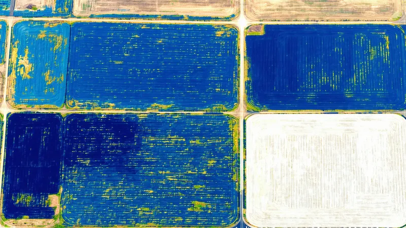
Synthetic aperture radar (SAR) offers a fundamentally different measurement of the agricultural surface. Where optical sensors measure reflected solar radiation in specific wavelength bands (giving us NDVI, Red-Edge indices, SWIR water indices), SAR transmits microwave pulses and measures the backscatter signal returned to the sensor. Microwave pulses penetrate cloud cover completely — the atmospheric conditions that make April optical imagery unusable in Kansas are invisible to a C-band SAR instrument like Sentinel-1.
For winter wheat canopies, C-band SAR backscatter responds primarily to two physical properties: canopy structure (stem density, leaf angle distribution, ear erectness after heading) and surface moisture (soil and vegetation water content). As winter wheat develops from tillering through heading, SAR VV (vertical-vertical polarization) backscatter follows a characteristic trajectory: backscatter increases through jointing as the canopy becomes more structurally complex, reaches a peak near heading when the ear structure produces strong radar returns, and then declines during grain fill as the canopy loses moisture and becomes more uniform.
This SAR phenological trajectory — increasing through jointing and heading, declining through grain fill — provides a development stage signal that is conceptually analogous to what NDVI provides for summer crops, but measurable through cloud cover. A sharp departure from the expected SAR trajectory (for example, a sudden backscatter decrease during the jointing-to-heading period) can indicate lodging from wind or rain, freeze damage that disrupts canopy structure, or early senescence from disease. These anomalies are detectable in the SAR signal even when optical imagery is unavailable.
What SAR Doesn't Provide for Wheat Monitoring
We should be direct about the limitations of a SAR-primary approach to winter wheat monitoring. SAR backscatter is sensitive to a different set of physical variables than NDVI, and not all of those variables correspond cleanly to yield-relevant physiology.
The most significant limitation is moisture sensitivity. SAR backscatter responds strongly to surface and vegetation water content, which means that rainfall events can produce large backscatter changes that have nothing to do with crop development stage or yield potential. A heavy rain in April that saturates Kansas winter wheat fields will temporarily increase SAR VV and VH backscatter substantially, which could be confused with a canopy development signal if the temporal context isn't carefully managed. Processing approaches that normalize SAR observations against precipitation records help mitigate this, but the moisture confounding cannot be eliminated.
SAR also does not measure photosynthetic activity. NDVI and its variants are mechanistically linked to the same light-use efficiency processes that drive biomass accumulation and, ultimately, grain yield. SAR is measuring structural and moisture properties that correlate with yield development stages but are not the physiological drivers of yield themselves. The correlation between SAR trajectory and final yield is real but looser than the NDVI-yield relationship — appropriate for development stage monitoring and damage detection, but less directly interpretable as a yield signal without additional calibration.
A Fusion Approach: SAR for Gap Filling, Optical for Calibration
The architecture that makes operational sense for winter wheat monitoring in cloud-prone growing regions is sensor fusion: Sentinel-1 SAR as the continuous monitoring backbone (weather-independent, 6-12 day revisit), supplemented by Sentinel-2 optical data for calibration and photosynthetic state assessment during the clear-sky periods that do occur.
The fusion logic works as follows: in periods with adequate optical coverage (typically late winter greenup in February-March, where cloud frequency is somewhat lower), optical NDVI calibrates the SAR-to-development-stage relationship for the current year. The calibration accounts for within-year variation in crop condition — a drought year will produce a different SAR trajectory than a high-yield year even at the same development stage. Once the optical-SAR relationship is calibrated for early-season conditions, SAR alone can carry the monitoring function through the cloud-heavy April-May critical period.
In practice, a representative scenario from the 2024 growing season in Barton County, Kansas illustrates this approach: satellite-derived GDDs and early-March optical NDVI measurements established normal spring greenup and healthy tiller density. Through April, 38 of 45 days were cloud-covered, producing only two usable Sentinel-2 acquisitions. Sentinel-1 SAR continued to provide 6-day acquisitions throughout April, showing a normal backscatter trajectory through jointing. A late April SAR acquisition showed an anomalous VH/VV ratio decrease across a 15,000-acre cluster of fields in the county's western half — suggestive of late freeze damage disrupting canopy structure. When clear-sky optical imagery became available in early May, Red-Edge NDVI confirmed significantly reduced canopy greenness in those fields, validating the SAR-detected anomaly. Total detection lag: approximately 8 days from freeze event to confident damage identification, compared to what would have been 30+ days if the monitoring system waited for optical imagery alone.
Implications for Hard Red Winter Wheat Insurance
Hard red winter wheat is one of the most complex crops to insure in the US program. Multiple peril exposures — winterkill, late freeze at jointing, spring drought, Hessian fly, wheat streak mosaic, harvest-time rains that reduce test weight — span a 9-month growing season. The RMA's loss-cost factors for winter wheat counties in Kansas and Oklahoma reflect historically elevated loss ratios relative to summer crops, partly because the monitoring tools available to underwriters have historically been weaker for winter wheat than for corn and soybeans.
A monitoring architecture that combines SAR continuity through spring cloud cover with optical calibration during clear-sky windows can materially change the in-season loss estimation capability for winter wheat policies. The 8-day detection lag in the Kansas freeze example above — identifying the damage cluster before optical imagery was available — represents the practical insurance value of radar-supplemented monitoring: earlier reserve adjustments, more precise in-season loss estimates, and a tighter P10/P90 yield distribution at policy pricing renewal. That's not a hypothetical future capability. It's what a properly architected multi-sensor monitoring system provides today.