The shift from county-unit to enterprise-unit policies has been one of the most significant structural changes in USDA crop insurance program participation over the past decade. Enterprise-unit policies allow farmers to combine multiple tracts within a county into a single insured unit, improving premium efficiency for operations with diversified field-level risk. What the program structure has not kept pace with is the actuarial precision required to price enterprise-unit policies accurately — and the bottleneck, specifically, is field boundary data.
Why Parcel-Level Precision Matters in Enterprise Unit Underwriting
When a crop insurance agent writes an enterprise-unit corn policy covering 2,400 acres across 18 separate fields in Champaign County, Illinois, the actuarial pricing factors that govern that policy are still derived from county-average loss-cost tables. The RMA county factor for Champaign County corn reflects the aggregate yield experience of all insured corn in that county — prime ground and marginal ground, irrigated and dryland, well-drained and poorly drained, all blended into a single pricing multiplier.
The enterprise-unit structure is supposed to diversify the policyholder's risk across their total operation. But actuarial pricing remains county-average. If the policyholder's 18 fields happen to be concentrated on lighter soils in the western portion of the county — systematically riskier than the county average — the enterprise-unit premium will be systemically under-priced for that specific operation. This is the APN-level pricing gap: the coverage structure has become more granular than the actuarial pricing that governs it.
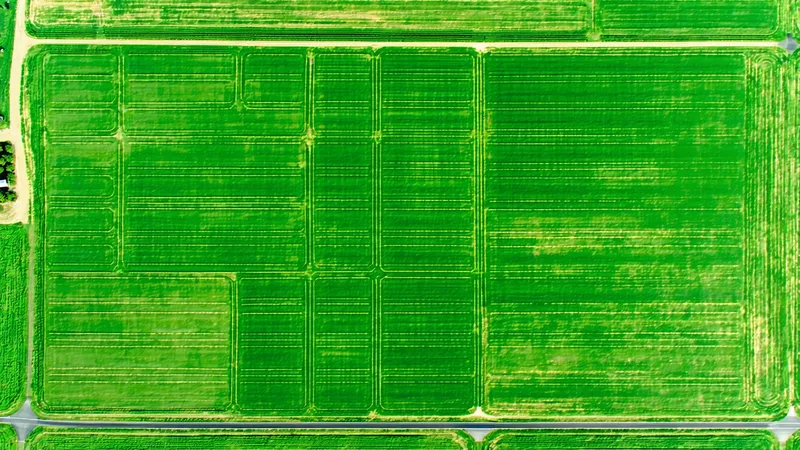
What "Field Polygon" Actually Means in a Data Context
In geospatial terminology, a field polygon is a vector boundary that delineates the geographic extent of an individual agricultural field or management unit. It differs from a county FIPS code (a numeric identifier for a county-level geographic unit) or a CLU (Common Land Unit, USDA's legal field boundary identifier) in important ways:
- CLU boundaries are USDA-maintained administrative boundaries tied to Farm Service Agency field records. They are the official field delineation used for program administration. They are not always current — field consolidations, drain tile installations, and field boundary changes between FSA updates can leave CLU records 2-5 years out of date in actively managed operations.
- APN (Assessor Parcel Number) boundaries are county tax assessor records that identify legal parcel boundaries. These track ownership, not field management. A single legal parcel may contain multiple cropped fields separated by tree lines, drainage features, or roads. Conversely, a single management field may span two legal parcels under different ownership.
- Satellite-derived field boundaries are delineated computationally from imagery — specifically, from field edge detection in multispectral imagery using textural and spectral gradient algorithms. They represent the actual cultivated extent of a management unit as visible from orbit, updated each growing season.
For insurance purposes, the relevant boundary is the management field: the area that was planted, managed, and will be harvested as a single unit. Satellite-derived boundaries are the closest proxy to this operational reality.
A Concrete Example: The Central Indiana Field Portfolio Problem
Consider an agricultural lender in central Indiana managing collateral documentation for a portfolio of farm loans in Tippecanoe and White counties. As part of a crop insurance program review in 2024, the lending institution attempted to match their borrowers' insured enterprise-unit policies against actual field-level yield monitoring data to assess concentration risk within their loan portfolio.
The problem they encountered: their internal field records were keyed to FSA CLU numbers, the insurance policies were written using county-unit identifiers, and neither mapped cleanly to individual field polygons in a geospatial system. Translating enterprise-unit policy coverage to individual field locations required manual cross-referencing of FSA maps, county parcel records, and farming operation records — a process that took weeks per major borrower.
Satellite-derived field boundaries, keyed to stable GeoJSON polygon IDs and cross-referenced to both FSA CLU numbers and county parcel identifiers, provide the anchor layer that makes this cross-referencing computational rather than manual. Once the link between insurance policy coverage and satellite field polygons is established, the yield monitoring data flows directly to the relevant policy — and the loss history accumulates in a form that can inform future actuarial adjustments at the APN level.
The Automated Field Boundary Pipeline
Producing accurate field boundaries from satellite imagery at scale requires solving several well-documented remote sensing challenges:
Field edge detection: Agricultural field boundaries produce spectral and textural gradient signals at the pixel level — the transition from a corn field to a road margin, tree line, or adjacent field produces a detectable change in reflectance. Object-based image analysis (OBIA) approaches that group spectrally similar pixels into objects and detect boundary regions have proven more reliable than per-pixel classifiers for this task. Convolutional neural network architectures trained on manually delineated field boundary training data have further improved detection accuracy, particularly in regions with irregular field shapes.
Seasonal consistency: Field boundaries derived from mid-season imagery (July for corn, August for soybeans) may differ from boundaries derived from early-season or post-harvest imagery when crop cover is minimal. A production system needs to reconcile boundaries derived across different seasonal windows into a stable polygon dataset that persists year-to-year unless a genuine field structure change occurs.
Edge cases: Pivot irrigation fields (circular field footprints), strip-till operations that produce textural boundaries within a single management unit, and terrace farming on sloped ground all produce edge detection artifacts. Manual quality control remains necessary for a meaningful minority of complex field geometries, even in well-trained automated systems.
Connecting Polygon Data to the Insurance Rating Workflow
The actuarial value of field polygon data is only realized if it connects to the rating workflow where pricing decisions are made. The technical connection requires three things that satellite data providers often underestimate: a stable field identifier that persists across growing seasons and can be referenced in policy records, a clean geocode-to-parcel lookup that allows matching on existing APN or CLU identifiers without requiring a GIS specialist to operate, and a delivery format that insurance rating systems can ingest without custom engineering.
REST API delivery with GeoJSON field boundaries and NDVI/yield attributes keyed to stable polygon identifiers addresses the first two requirements. The third — format compatibility with specific rating engine architectures — is where implementation support matters. A crop insurer running enterprise-unit policies on a commercial rating platform has specific data ingestion requirements that a generic GeoTIFF export does not satisfy. The value proposition of field polygon data for APN-level underwriting is clear; the barrier to adoption is almost always integration friction, not data quality.
We're not saying field polygon data alone solves the actuarial pricing gap in enterprise-unit crop insurance. Field boundaries are the necessary foundation — without them, satellite yield data cannot be attached to a specific policy. But the actuarial adjustment methodology built on top of that foundation requires dedicated actuary engagement, RMA program compliance review, and multi-year loss experience development at the field level before field-specific pricing factors can be formally filed. The polygon data gets the process started. The actuarial work takes longer than the technology does.