County-average loss-cost factors were a reasonable approximation in 1980. The USDA Risk Management Agency built its county-unit actuarial structure on survey data collected from thousands of farms aggregated into county-level yield histories. For decades, this was the best available data. Today, it is a structural liability — and the crop insurance industry is beginning to feel it.
What Basis Risk Actually Means in Crop Insurance
Basis risk, in the insurance context, refers to the divergence between the indemnity trigger and the actual loss experienced by the policyholder. In index-based products — area yield plans, county yield index policies — basis risk is inherent: the policy pays based on county-average outcomes, not individual field outcomes. A farmer who loses 40% of yield on a drought-stressed sandhill farm in Dawson County, Nebraska may receive no indemnity if the county average holds above the trigger threshold because the loam fields ten miles north had a banner year.
This is not an edge case. It is a predictable structural feature of any product that uses geographic aggregates as a proxy for individual loss. The question is whether the mismatch has grown large enough to represent actuarial failure — and the evidence suggests it has.
The Within-County Yield Spread Has Been Growing
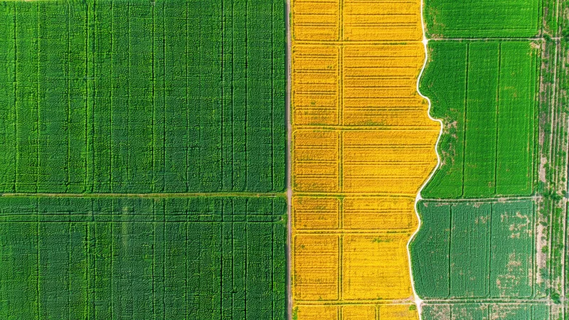
USDA NASS county yield surveys capture aggregate outcomes at the county unit. What they do not show — because they are designed as summary statistics, not field-level observations — is the distribution of outcomes within that county. When you overlay field-level satellite yield estimates against NASS county averages across major corn belt counties, a consistent pattern emerges: the within-county coefficient of variation in field-level yields has expanded materially over the past two decades.
Consider a representative scenario: in a 2023 growing season, Boone County, Iowa logged a county-average corn yield within normal range. But field-level NDVI analysis shows that fields on poorly drained soils in the western third of the county — where a May planting delay caused emergence stress — produced yields 22-28% below county average. Fields on tiles-drained ground in the eastern portions showed yields 8-14% above average. The county average masks a 35-40 bushel-per-acre spread within a single county unit.
For an enterprise-unit or basic-unit policyholder whose operation concentrates on the stressed western fields, a county-average-based area plan triggered no indemnity. Their actual loss ratio was well above 1.0. Their actual policy paid out based on a number that bore limited relationship to their realized experience.
Why the Spread Is Getting Worse, Not Better
Several structural factors have been compounding within-county yield variability since the 1990s:
- Land-use intensification at marginal margins: As commodity prices increased through the 2000s and 2010s, cropland expanded onto marginal soils — sandier, shallower, more drought-susceptible. These fields now sit alongside high-productivity prime ground in the same county units, increasing variance.
- Drainage heterogeneity: Tile drainage adoption is uneven within counties. Poorly drained fields face spring planting delays, anaerobic stress events, and yield drag that tile-drained neighbors avoid. This effect is spatially concentrated.
- Climate variability patterns: Drought stress, heat events, and heavy precipitation events increasingly operate at sub-county spatial scales. A 2022 derecho damage corridor in central Iowa was 15-20 miles wide — affecting specific townships, not whole counties.
- Irrigation heterogeneity: In the High Plains, irrigated center-pivot fields and dryland fields can coexist in the same county. In drought years, they diverge by 80-100 bushels per acre. WASDE and NASS county data average across both.
The RMA has recognized this, progressively expanding the Basic Unit, Optional Unit, and Enterprise Unit structures to allow more precise policy structures. But those structures still depend on county-level actuarial tables as the pricing anchor. The pricing signal remains blunt even when the coverage structure becomes more granular.
The Underwriter's Adverse Selection Problem
Here is where basis risk becomes commercially dangerous, not just theoretically imprecise. When county-average actuarial factors systematically under-price risk on marginal-soil operations and over-price risk on prime-ground operations, a predictable selection dynamic emerges over time.
Farmers and agents are not unsophisticated. A farm manager operating on drought-prone ground in a county where the actuarial factor reflects average productivity across both high and low productivity land knows his risk profile exceeds his premium. He buys more coverage. The prime-ground operator finds his premium slightly above market for his risk profile — he may self-insure, purchase minimum coverage, or shop aggressively for multi-year good-experience discounts.
Over time, without corrective action, the insured portfolio drifts toward the worse-than-average tail of the within-county distribution. Loss ratios creep up not because of weather getting worse, but because selection has drifted. The county actuarial factor hasn't changed; what's changed is who is in the pool.
We're not saying county-level actuarial factors are wrong as a starting point. The RMA's actuarial science is rigorous, and for a national program serving millions of policies, county-level tables represent a reasonable design constraint. What we're saying is that for individual underwriters writing enterprise-unit or APN-level policies in specific geographies, layering sub-county field data on top of county tables is no longer a refinement — it's a risk management necessity.
What Field-Level Data Changes in the Pricing Equation
Field polygon data — specifically, satellite-derived NDVI time-series at sub-10-meter resolution tied to specific parcel boundaries — changes the basis risk equation in two concrete ways.
First, it allows actuaries to observe the historical yield performance of specific fields rather than inferring it from county averages. A field that has shown NDVI anomaly scores 15% below county average during stress years, across eight growing seasons, is demonstrably riskier than the county actuarial factor implies. That observable history justifies an actuarial adjustment.
Second, it enables in-season loss detection with greater spatial precision. When a policy is attached to a specific field polygon rather than a county unit, and the season's NDVI trajectory for that field diverges from historical norms by mid-July, the expected loss is calculable with materially less uncertainty than a county trigger can provide. This reduces both over-payment (indemnifying county-average loss when a specific field didn't lose) and under-payment (county-average holds when a specific field suffered).
The Practical Implementation Gap
The technology to do sub-county actuarial pricing has existed since Sentinel-2 data became commercially available at scale. The bottleneck has not been data — it's been the absence of a clean interface between geospatial data products and the actuarial rating engines where pricing actually happens.
Most crop insurance rating workflows run on systems that ingest structured relational data: county FIPS codes, crop codes, practice codes, APH yields, RMA county factors. A GeoTIFF raster product requires GIS expertise to consume. A REST API that returns GeoJSON field boundaries with NDVI time-series and yield probability distributions, keyed to the same field polygon identifiers used in the policy application, changes that calculus entirely — and that is precisely the integration architecture that field-level data platforms must solve.
The actuarial improvement from sub-county data is not speculative. The spatial heterogeneity within county units is measurable, the selection dynamics from blunt county pricing are predictable, and the satellite data to capture field-level yield signals exists at operational scale. The question for underwriting teams evaluating field data is no longer whether the data is good enough — it's whether the integration path is tractable enough to act on.